China Train Network Map 2026: How to Read the Routes and Plan Your Trip
Quick answer: China's high-speed rail map is built around eight "vertical" (north-south) and eight "horizontal" (east-west) corridors that connect almost every provincial capital and city with over 500,000 people. Once you know the corridor your route sits on, reading train times and choosing connections gets a lot easier, and the official planner at 12306.cn or Trip.com will fill in the exact schedule.
Search "China train network map" and you'll mostly get dense, low-resolution diagrams that are hard to read on a phone. The map itself matters less than understanding the shape of the network, because that shape tells you which cities are natural stopovers, which routes have the most frequent departures, and where a "direct" train might actually not exist yet.
The shape of the network: 8 vertical + 8 horizontal corridors
China's rail planners describe the high-speed network as "eight vertical, eight horizontal" (Ba Zong Ba Heng), a national blueprint from the National Development and Reform Commission that's been the backbone of route planning since 2016. As of 2026 the network has passed 50,000 km of track, more than the rest of the world's high-speed lines combined, and it's still growing by roughly 2,000 to 3,000 km a year toward a 2030 target of 60,000 km.
The eight vertical (north-south) corridors include the Coastal corridor, the Beijing-Shanghai corridor, the Beijing-Hong Kong corridor, the Beijing-Harbin corridor, and lines running toward Kunming, Nanning, Haikou, and Lanzhou/Xining-Guangzhou in the west and southwest.
The eight horizontal (east-west) corridors include the Beijing-Lanzhou corridor, the Qingdao-Yinchuan corridor, the Yangtze River corridor (Shanghai-Chengdu), the Shanghai-Kunming corridor, the Xiamen-Chongqing corridor, and the Guangzhou-Kunming corridor, among others.
You don't need to memorize all sixteen. What matters for trip planning is recognizing that most tourist routes ride on just a handful of them:
| Corridor | Roughly connects | Useful for |
|---|---|---|
| Beijing-Shanghai (coastal vertical) | Beijing, Tianjin, Nanjing, Suzhou, Shanghai | The busiest single line in the network, trains every few minutes at peak times |
| Beijing-Hong Kong / Guangzhou | Beijing, Wuhan, Changsha, Guangzhou, Shenzhen, Hong Kong | North-south trunk route, links to Guangdong and the Pearl River Delta |
| Shanghai-Kunming (horizontal) | Shanghai, Hangzhou, Changsha, Guiyang, Kunming | East-to-southwest route, gateway to Yunnan |
| Xi'an-Chengdu / Lanzhou-Xinjiang | Xi'an, Chengdu, Lanzhou, into the northwest | Crosses the most mountainous terrain, more tunnels and slower average speeds |
| Beijing-Harbin | Beijing, Shenyang, Harbin | Northeast route, useful for Changbai Mountain and Harbin's Ice Festival |
How to actually read a network map
A few habits make any China rail map click faster:
- Look for the hub cities first. Beijing, Shanghai, Guangzhou, Wuhan, Zhengzhou, and Xi'an sit where multiple corridors cross. If your route doesn't run direct, one of these is almost always the connection point.
- Colors usually separate speed tiers. Most published maps use one color for 300+ km/h lines (Fuxing-capable) and another for slower 200-250 km/h regional lines. A route drawn in the slower color will take noticeably longer even over a similar distance.
- Distance on the map doesn't equal travel time. The Xi'an-Chengdu line looks short on a flat map but crosses the Qinling mountains through dozens of tunnels, so it runs closer to 3-4 hours despite being under 700 km. A flatter, similar-length route on the coastal corridor can be 30-45 minutes faster.
- "High-speed" covers a speed range, not one number. Lines are rated at 250, 300, or 350 km/h depending on when they were built and the terrain. The network map doesn't usually show this, so cross-check with the actual train schedule.
Where to find a live, interactive map
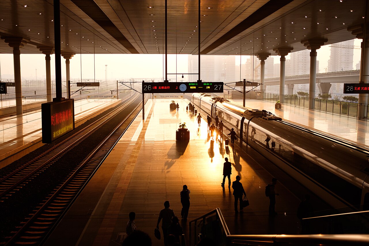
Sunset at Nanjing South Railway Station, a major hub on the Beijing-Shanghai corridor
Static images are fine for understanding the overall shape, but for planning an actual trip you want something you can search and zoom:
- 12306.cn is China Railway's own booking site and has the most accurate, current schedule data since it's the source everyone else pulls from, though the interface is built for booking, not visual browsing (see our step-by-step booking guide if it's your first time).
Search China train routes on Trip.com
English interface, same 12306 inventory, easier for foreign cards
Some links are affiliate links; we may earn a commission at no extra cost to you.
- Third-party rail-mapping sites (search "China railway map" plus the current year) let you click a station or enter a train number to trace its route, which is a faster way to see how corridors connect than reading a static PDF.
Using the map to plan a multi-city route
Once you can picture the corridors, building a route is mostly a matter of picking cities that sit along the same line or share a hub:
- Plot your must-see cities first, then check which corridor each one sits on. Beijing, Xi'an, and Chengdu, for example, chain together along the Beijing-Xi'an and Xi'an-Chengdu lines without much backtracking.
- Use hub cities as natural overnight stops. Wuhan and Zhengzhou both sit at corridor intersections, so splitting a long trip with a night in one of them usually beats a single very long travel day.
- Check whether your route needs a transfer before you book. Some city pairs that look adjacent on the map, like Guilin to Yangshuo, don't have a direct high-speed station at the destination, so you're actually booking a train plus a shuttle bus.
- Build in slack around mountain corridors. Routes through Sichuan, Yunnan, Tibet, or Xinjiang run through more tunnels and stick closer to 250-300 km/h even on newer track, so pad your connection times more than you would on the flat coastal lines.
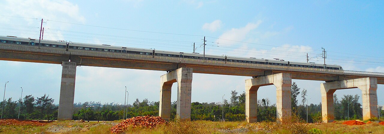
High-speed train crossing an elevated viaduct in the Chinese countryside
FAQ
What does "eight vertical, eight horizontal" mean? It's the name for China's national high-speed rail blueprint: eight north-south corridors and eight east-west corridors that together form the backbone of the network, first laid out by the National Development and Reform Commission in 2016.
How long is China's high-speed rail network in 2026? Over 50,000 km, more than the rest of the world's high-speed lines combined. The government's target is 60,000 km by 2030 and 70,000 km by 2035.
Is there one official app or website for the train network map? 12306.cn is the official booking platform and the most accurate source for routes and schedules, though it's designed for buying tickets rather than browsing a visual map. Trip.com mirrors the same ticket inventory with an English interface.
Do all high-speed lines run at the same speed? No. Lines are built for 250, 300, or 350 km/h depending on when they opened and the terrain they cross. Mountain routes typically run slower even when they're technically "high-speed."
Why doesn't the map show a direct train between two nearby cities? Not every pair of cities on the same regional map is connected by a dedicated high-speed line yet. Some routes still require a transfer at a hub city, or a short bus connection at the far end, even when the cities look close together.
Sources
- China Railway 12306 English Ticketing Platform · China Railway
- China Railway 12306 Registration · China Railway
- Secrets of Train Numbers · Beijing Municipal Bureau of Culture and Tourism
- What can I do if I board the wrong train or alight at the wrong station? · Shanghai Municipal Government